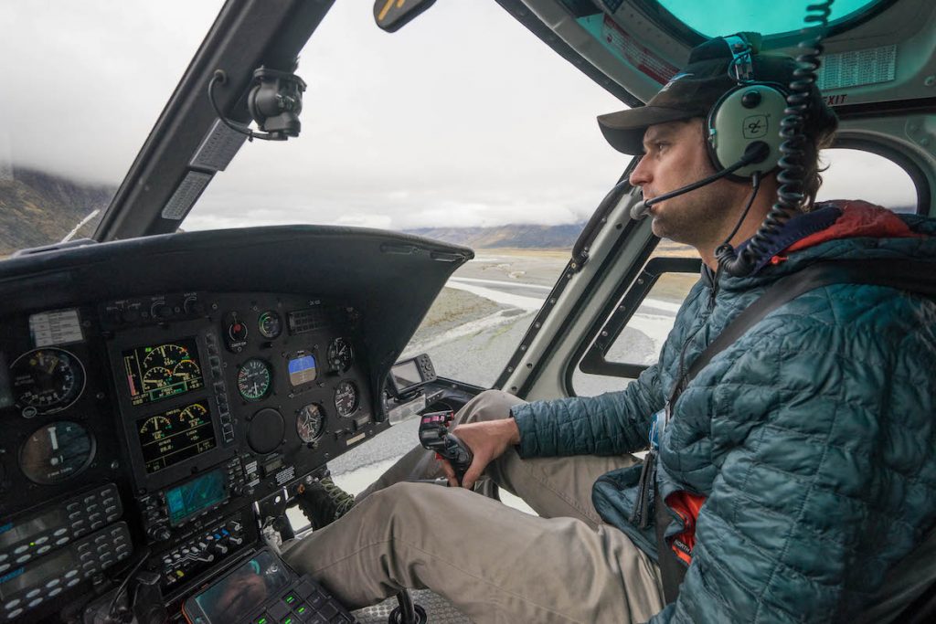
The helicopter whirred away over the river and was gone. We were on our own now. And in the middle of nowhere.
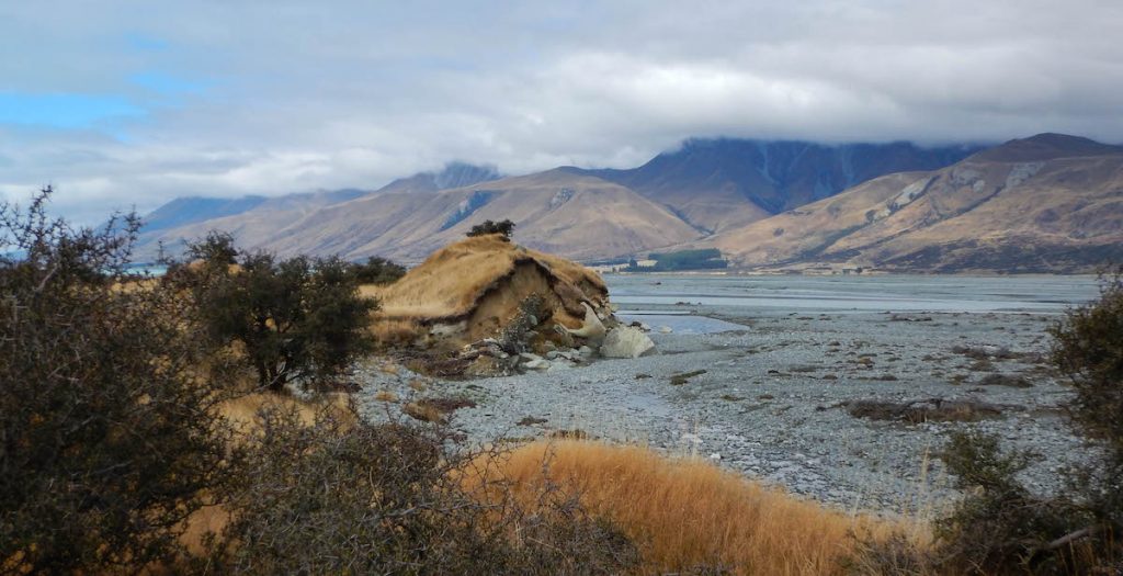
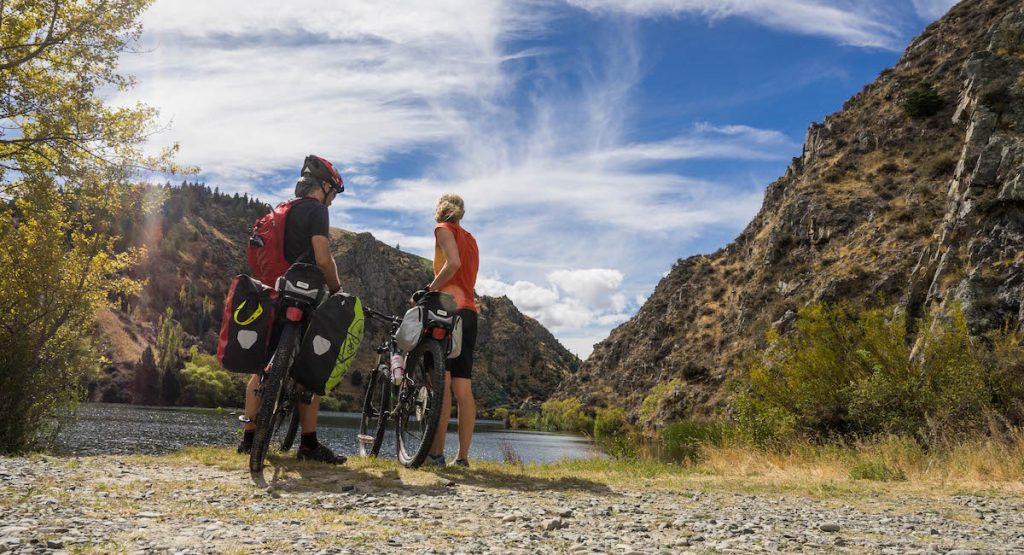
Surrounding us were the rugged brown mountains of New Zealand’s Southern Alps, and beside us, the braided Tasman River, its main channel winding south through the grey stones like a long turquoise serpent. On a nice day this would have been a great spot to view Mt Cook, but on this particular day the mountains were all wearing a heavy cloak of cloud, with only their feet poking out the bottom.
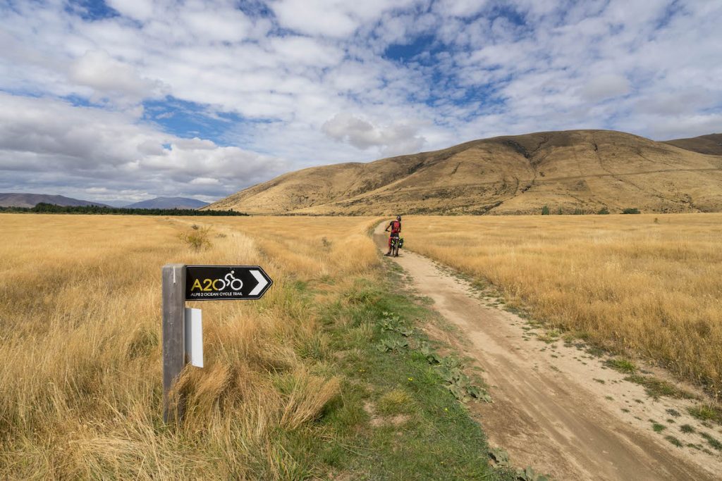
Now when I say we were in the middle of nowhere, it only appeared to be that way. The helicopter flight from Mt Cook Airport had taken less than five minutes. Though to be fair, we could not see the airport from here and apart from the sign indicating we were at Tasman Point, and a narrow rocky path heading south, there were no other signs of civilisation. So as far as we were concerned – middle of nowhere!
This was day 1 of our six day ride along the Alps 2 Ocean Cycle Trail (A2O). Starting at Aoraki/Mt Cook in New Zealand’s southern alps and finishing 306km later in Oamaru on the east coast, the trail would take us through some of the most spectacular and varied scenery on the South Island. Passing jagged mountains, turquoise lakes and lush farmlands, it promised to be a spectacular journey. The only tricky part was that I actually had to cycle 306km… Eeek!
The Route
We chose to do the trail over six days, but you could do it in more or less.
Our schedule:
- Day 1 – 77km – Aoraki/Mt Cook to Twizel
- Day 2 – 38km – Twizel to Lake Ohau Lodge
- Day 3 – 45km – Lake Ohau Lodge to Omarama
- Day 4 – 64km – Omarama to Kurow
- Day 5 – 28km – Kurow to Duntroon
- Day 6 – 54km – Duntroon to Oamaru
Considering the furthest I’d ever cycled in one go was 45km (on a road bike on nice smooth bitumen), this was going to be a bit of a challenge. I apologised to my butt in advance.
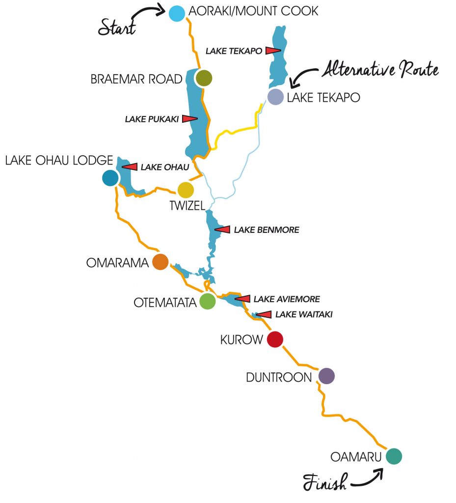
Aoraki/Mt Cook was the true start of the Alps 2 Ocean trail. But starting from here meant it was necessary to get a helicopter across the Tasman River. Those who did not want to fork out for a helicopter could go via the alternative route which starts at Lake Tekapo. I insisted on going from the true start. Just because it seemed more official. And I love helicopters.

The Trail
The A2O is advertised as being easy to intermediate grade, suitable for all ages. The accessibility of the trail means you do not need to do all 306km but can easily do a section or two as a day trip. For us it was all or nothing. We were in for the long haul!
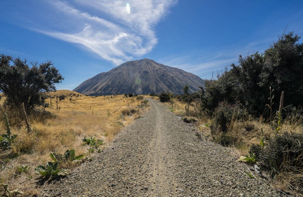
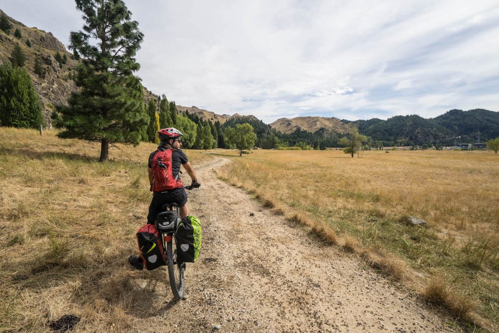
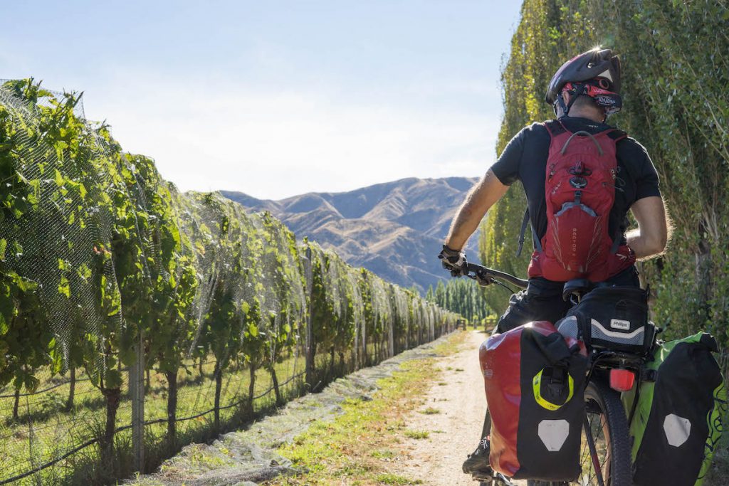
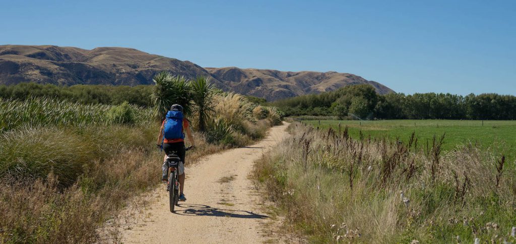
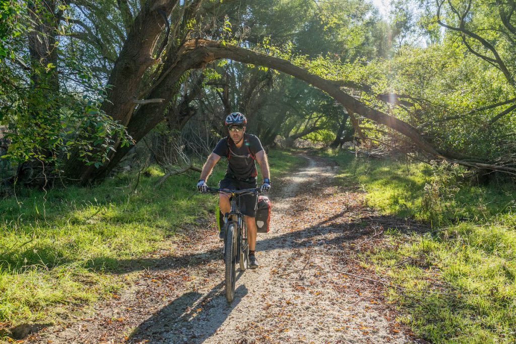
More than half of the trail is purpose-built off-road cycle track. These tracks varied from a nice smooth shingle, to dirt, gravel and some rough, rocky and hummocky stuff. The rest of the trail is road, either gravel or sealed. But before you bemoan the fact that you have to ride on some roads, be reassured that most of these are very quiet farm roads, and indeed there were some stretches where we did not see any vehicles at all. And the cars we did see were generally very considerate and gave us plenty of room.

The A2O is being upgraded all the time, with the aim to get as much of it off-road as possible. Admittedly some of the road sections could be a little boring, but some were great fun, particularly the steep descents where Mr Ironman dared me not to use the brakes…
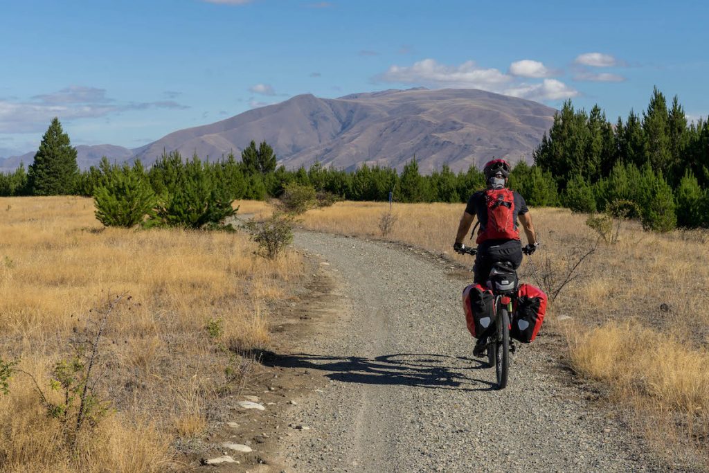
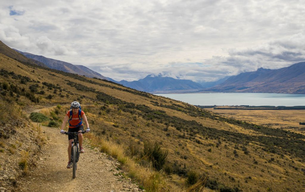
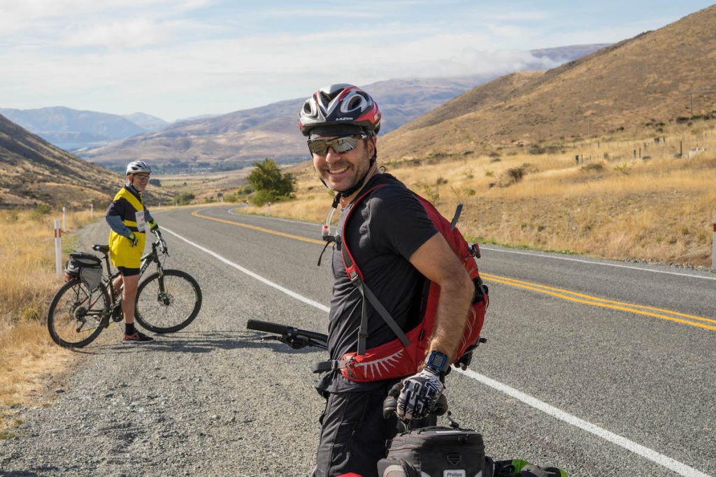
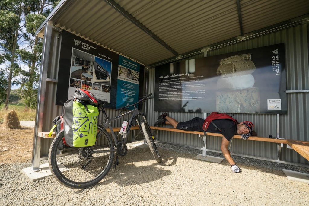
Day 1 – Aoraki/Mt Cook to Twizel – 77 km
Mt Cook Airport (where the helicopter departed from) was only 8 km from the start of the trail. The bikes were loaded into a big crate and taken across the Tasman River first. We followed soon afterwards. Not in the crate though – that would probably violate some aviation law I expect. Instead I rode in the front seat (YES!!) and for less than 5 minutes I enjoyed the views of the braided river below. It was, I think, the shortest chopper ride in history 😉 However, as I absolutely love helicopters, any minute spent in one is awesome.

And so there we were, at the remote Tasman Point, the helicopter gone, and our bed for the night 70km away. It was just us, the bikes, and about a million fun-size snickers bars.

The first day was not only the longest, but the toughest. Rough rocky tracks, a creek crossing, gravel road with vicious corrugations. Add to this frozen toes, a nasty headwind and sore knees and it became quite a big day.
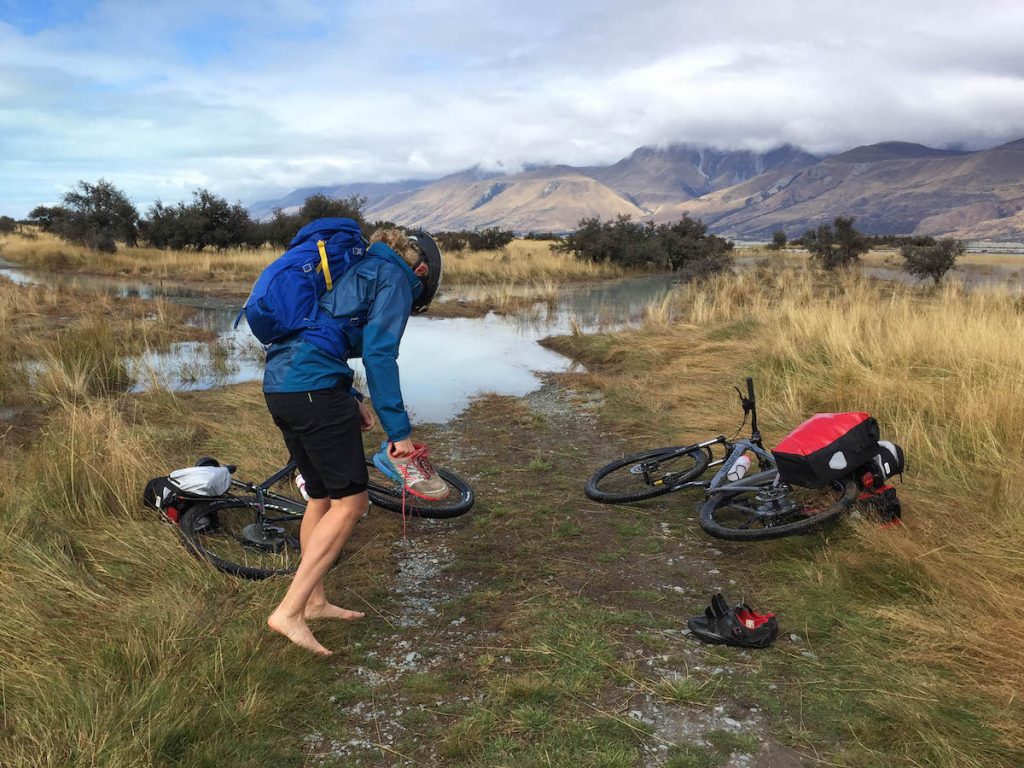
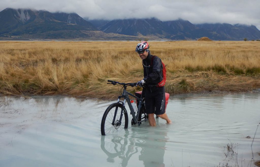
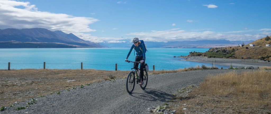
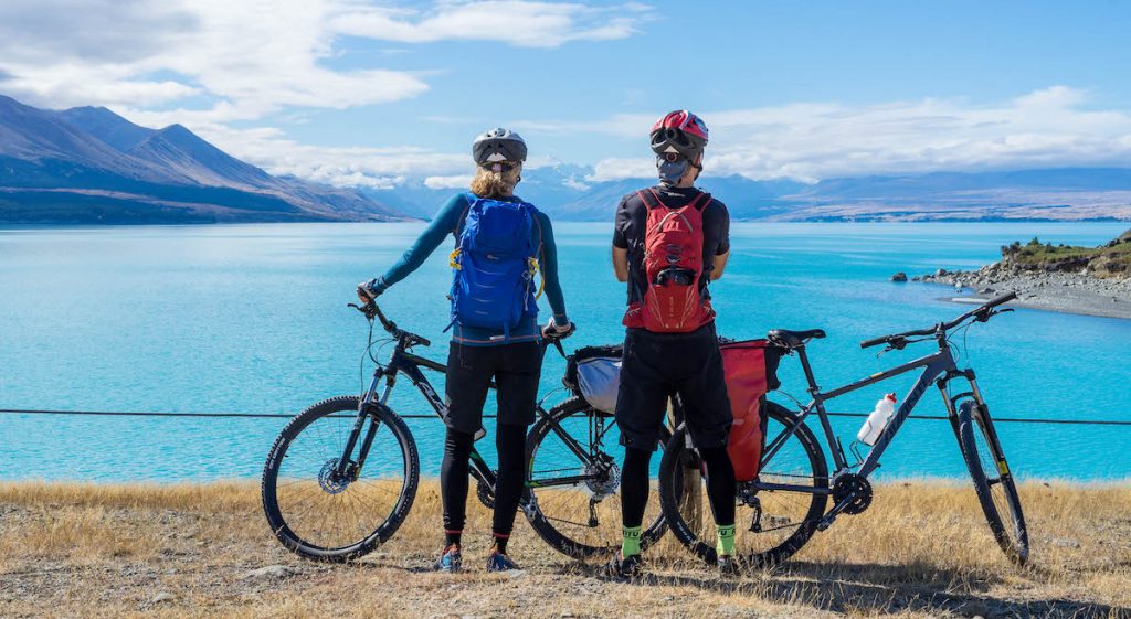
There were some very cool bits though: The helicopter ride across the Tasman River; the remote and beautiful trails along the glacier carved valley; the creek crossing (fun despite how bloody freezing it was!); the stunning turquoise Lake Pukaki and (eventually) the view of Mt Cook.

We’d gone for most of the day seeing only a few other people so it was a bit of a shock when we hit the southern end of Lake Pukaki and there were tourists everywhere. It seemed we were back in civilisation. Boo…
Oh, and the clouds gradually lifted during the day so we (at last) got our view of Mt Cook 🙂

There was a lady in a skimpy bikini reclining on a boulder by the water while her man snapped many photos of her. I decided to recreate the moment. I think the tights under the shorts are particularly fetching 😀

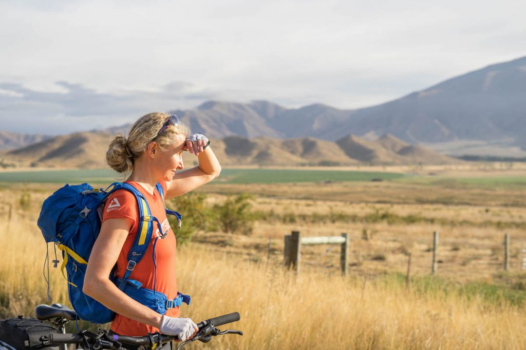
We said goodbye to Lake Pukaki and headed across Pukaki Flats, the last 11km before we hit the town of Twizel. I quite enjoyed this section. The riding was easy and the open grassy landscape ringed by mountains was really pretty.

We covered 83km on that first day, arriving in Twizel at about 6pm. At dinner I ate like I hadn’t seen food for a month. That pork belly didn’t stand a chance!
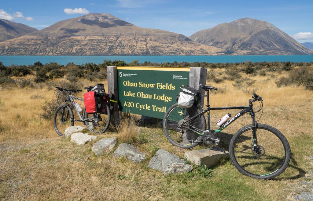
Day 2 – Twizel to Lake Ohau Lodge – 38km
After collecting a couple of handfuls of plums from a tree at our Airbnb, we mounted our trusty steeds and headed off (we would relish these plums for the next 3 days and wish we’d picked more).

The first 18km was on sealed road and to be honest it was a bit of a struggle. Although the scenery was still quite nice, and the few cars that passed us were very considerate, there is something about the physical monotony of flat, straight road that makes things start to hurt. My knees were giving me a bit of grief and my butt was also starting to complain. Mr Ironman knew I was struggling because I was not talking as much as usual. I believe he was enjoying the peace.
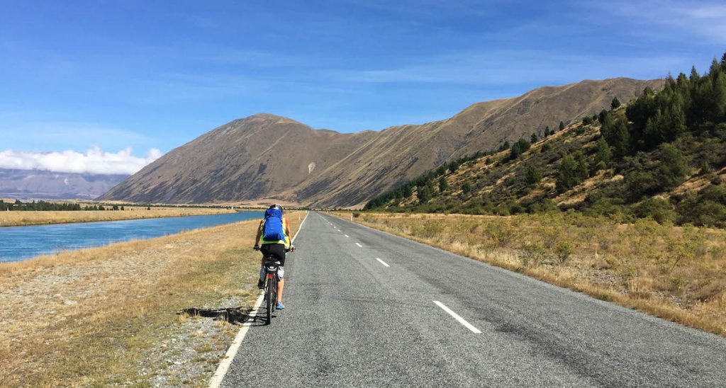
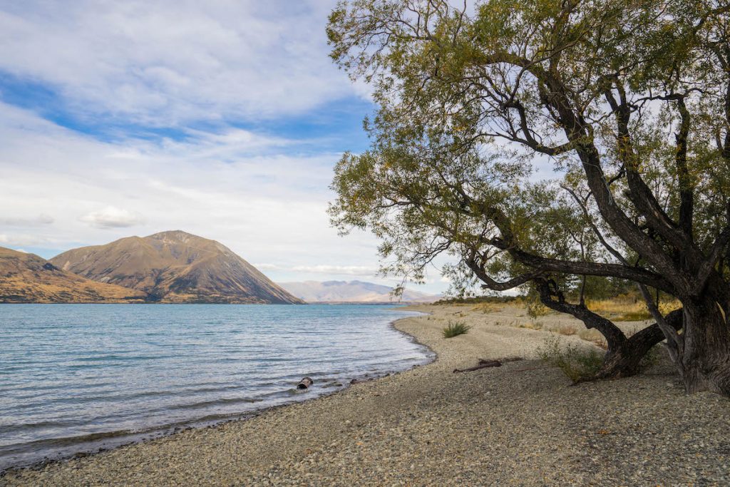
It was a whole other story when we reached the stunning Lake Ohau. Here the sealed road turned into a narrow gravel cycle track. The trail skirted the southern edge of the lake. There were twists and turns and ups and downs. And a few bits of single-track beside steep drop-offs that got the adrenaline flowing nicely. So different to the sealed road we’d left behind! Suddenly all the aches and pains were gone and I was enjoying myself very much.


Another section of sealed road took us to the cosy Lake Ohau Lodge, perched on a hill overlooking the lake.

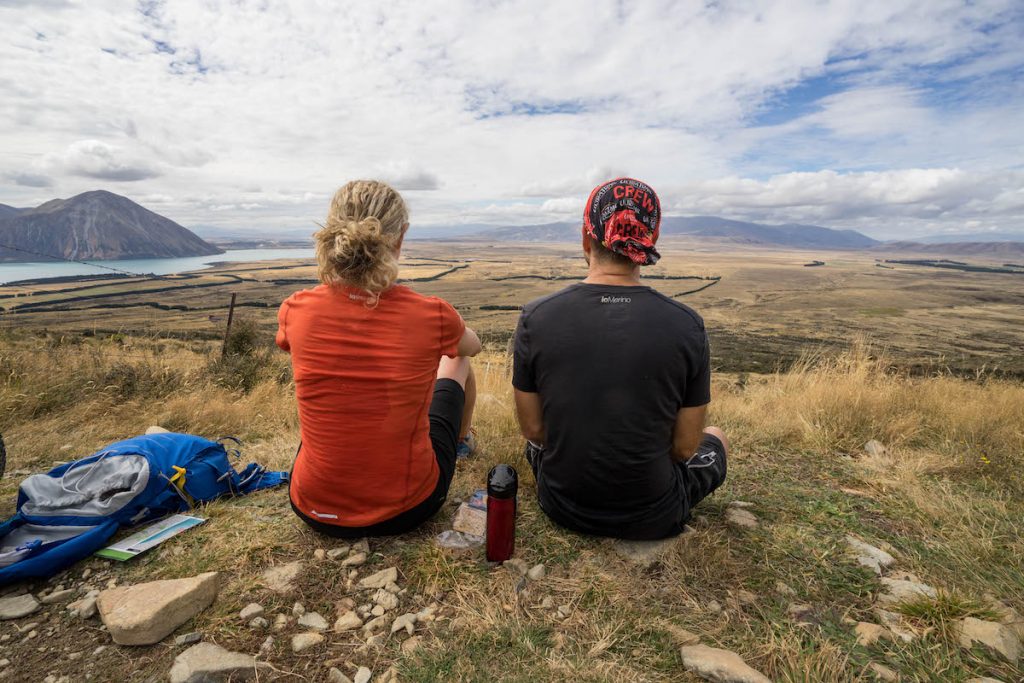
With beautiful views, hot tubs and lots of food, Lake Ohau Lodge was an excellent place to relax and recuperate. Mr Ironman convinced me to do the old hot tub, cold shower, hot tub, repeat thing. We had to be quick though because any skin exposed to the air for more than two seconds was pounced on by some mighty vicious sandflies.
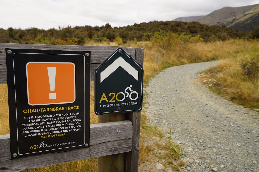
Day 3 – Lake Ohau Lodge to Omarama – 45km
As the name of the trail suggests, the A2O goes from the mountains to the coast, so it is, overall, a downhill ride. But you can’t ride 306km without a few uphills.
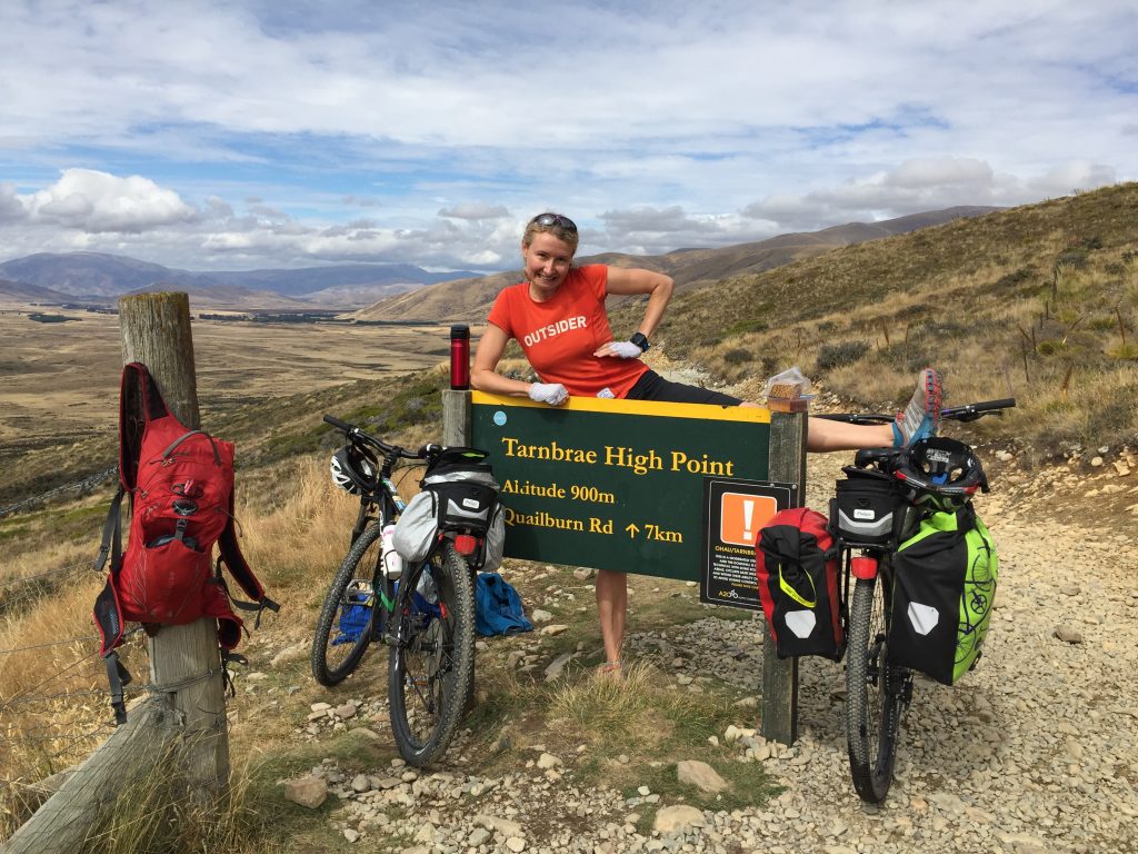
Day 3 had the first of the significant hills. We’d heard all about this ascent and how steep it was, so we went in with high expectations. But on our way up we would regularly say to each other “do you think the steep bit has started yet?” expecting something a lot worse. But no, that was the steep bit. Okay, I was puffed and quite sweaty by the time we reached the top, but it really wasn’t as bad as we expected.
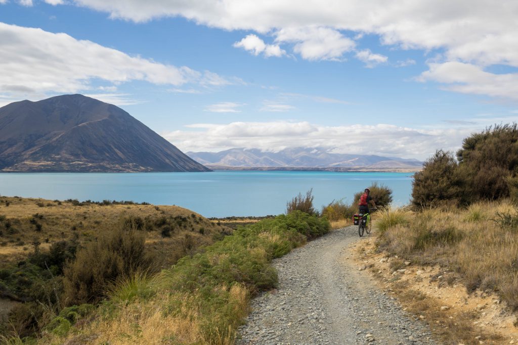
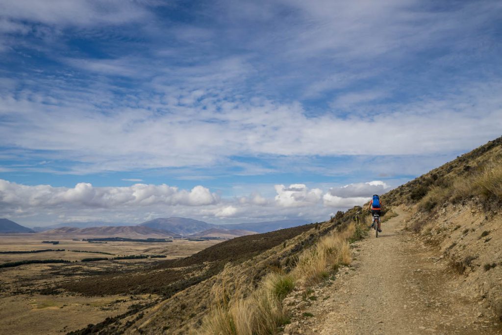
Day 3 was possibly my favourite day. The first 20 km was on cycle track, traversing the lower slopes of the Ruataniwha Conservation Park. We had stunning views of the Ben Ohau Range but the best bit was how far away we were from any roads and towns. And in that whole 20km (about 3 hours) we did not see another person. So peaceful!

Another reason I loved this day was that what goes up must come down. And after that steep ascent was about 3km of crazy, kamikazi downhill. It was steep, rocky, full of pot holes, and our bikes did not have rear suspension (OMG!). Admittedly I could have used the brakes a bit more but I didn’t want to wear them out 😀
Upon reaching the bottom, it took quite a while for my adrenaline to settle down and my teeth to stop rattling.
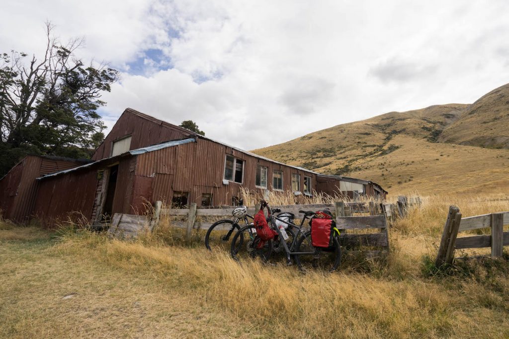
After a quick detour to check out the historic Quailburn woolshed, we cycled about 10km on quiet gravel road where we did not see another vehicle or person, then it was a bit of sealed road and some more cycle track to take us into the sheep-filled town of Omarama.

Day 4 – Omarama to Kurow – 68km
It was a chilly but pretty morning departing from Omarama, the land of the sheep (that’s not an official name by the way, but I think it is quite appropriate and I shall suggest it to the Mayor).
I took some photos of sheep.

Bernard stopped to watch some sheep.
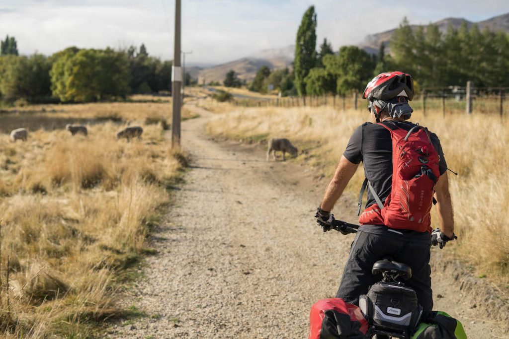
And some sheep left a lot of poo on the trail which was flung up by our wheels onto our backs and which attracted many millions of bugs which then flew into our mouths, up our nostrils, down our shirts and into the jungly depths of my hair.
But it was a very nice ride by the lake.


We met up with an Aussie group from Canberra who were also doing the A2O. We also met an American couple and a few other random cyclists. Busy day on the trail!
I donned the fluro vest as we took to State Highway 83. Though fortunately the traffic was pretty sparse. 5km of sweaty uphill took us onto the Otematata Saddle. One of the Aussie ladies passed me on the way up, and just as I was thinking “What the… I’m not as fit as I thought…” she said “Sorry! E-bike” and zoomed ahead.
Meanwhile, Mr Ironman was waiting for me at the top. Despite carrying most of our gear he was still faster than me. Even up the hills. Dammit!
On the other side of the saddle was 6km of steep downhill. Usually when we are about to descend a big hill, Mr Ironman will say “No brakes!” then zoom off. This time, considering we were on sealed road, I actually had the courage do it and indeed no brakes were applied in the descent of that hill. According to my Garmin I reached 60km/h, pretty sure I was grinning from ear to ear all the way down.
And this little piggy went “Weeeeeeeeeee….!!!!” all the way to Otematata.

Mr Ironman called Otematata “a sphincter of a town nestling in the butt cheeks of the Waitaki Hills”. This was purely because he couldn’t get a coffee there (the only place in town that was open and had a coffee machine decided that right when a bunch of coffee-craving cyclists arrived was a very good time to clean the machine).
And so the slightly grumpy coffee-starved Mr Ironman and I continued on our way. Along some pretty tracks…
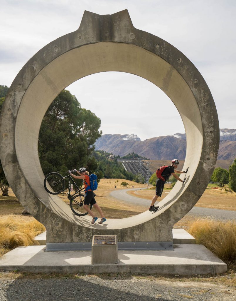
And up a big hill to a big hydro dam, where a big piece of pipe was just hanging about.
Another exciting descent down from the dam and Mr Ironman clocked up 65km/h. That’s because he has a lot of extra weight in the butt area. Okay, it was just the pannier bags but still…
A lot of Day 4 was on sealed road, so coming into Kurow, it was great to see some new off-road trail being built. Yay!
Day 5 – Kurow to Duntroon – 28km
Day 5 was the shortest day and off-road all the way. The flat trail passed through a winery, along a river, past cow paddocks and cropped fields and took a detour past some Maori rock art.

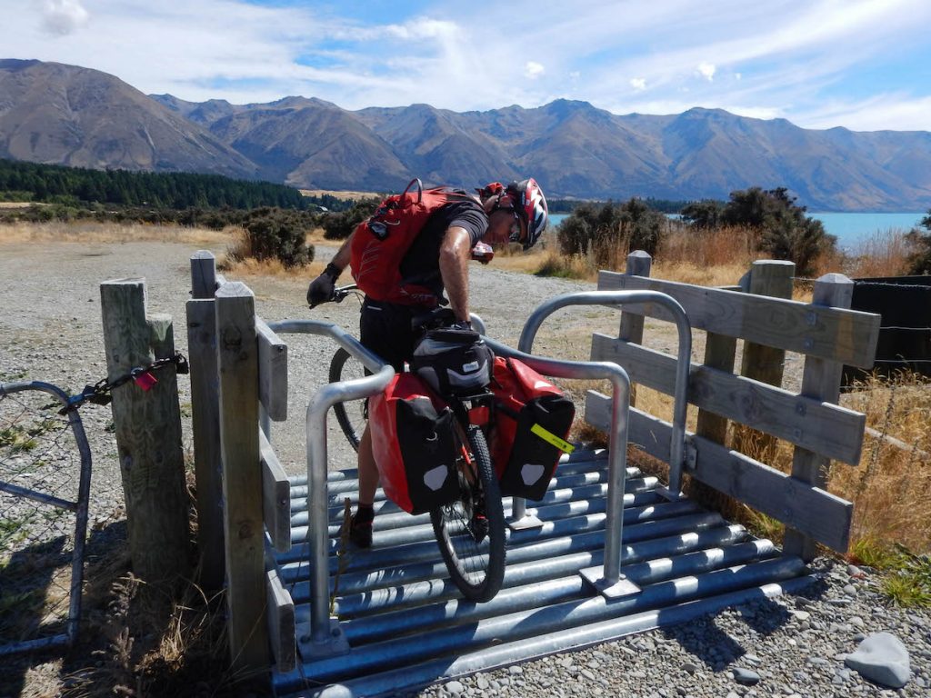
The only challenging sections of trail on this day (which were in fact the most challenging sections of the entire trail) were 3 dry creek beds. They were filled with large rounded rocks which made it really slippery and awkward. It would have probably been quicker to walk the bikes through.
The trail wound through the Duntroon Wetlands before arriving at the tiny town. Duntroon has a population of 114 but despite its size has a lot to offer travellers. There is the Vanished World which has lots of fossils of extinct dolphins, whales, sharks and penguins. There is also an old Blacksmith and the Duntroon Gaol.

There was one pub in town and luckily it was open that evening, otherwise it may have been cheese and crackers for dinner.
Day 6 – Duntroon to Oamaru – 54km
Last day and the trail was mostly off-road.
We explored Elephant Rocks, which was a heap of large odd-shaped rocks in the middle of a paddock, one of which indeed looked very much like an elephant!

The farmer who owned the paddock came for a chat and pointed out a dog, Winnie the Pooh and many other characters that appeared only when you looked from the right direction and squinted one eye.

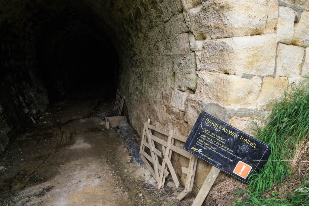
The trail passed through the Rakis Railway Tunnel. It was recommended you use a light to go through but we couldn’t be bothered going looking for ours so went in without. It was actually pitch black in there (like can’t-see-your-hand-in-front-of-your-face kind of black) and the floor was uneven with random puddles. I was half riding, half scooting along with one foot. It was very cool but also quite disconcerting to be unable to see anything.
We were winding our way along these trails through beautiful farmland, with rolling hills all around and suddenly our wheels touch bitumen and there is a church up ahead with a massive sign advising us that we could get coffee there. Well of course Mr Ironman made a beeline for that quaint little house of worship.
God’s Old House had been converted into a dwelling, the owner of which had cut a serving window into one wall and purchased a big fancy coffee machine. And this was just for A2O riders. How cool is that? He certainly wouldn’t be making much money from it, but for coffee-drinking cyclists it was a god-send! (I know, I’m soooo funny).
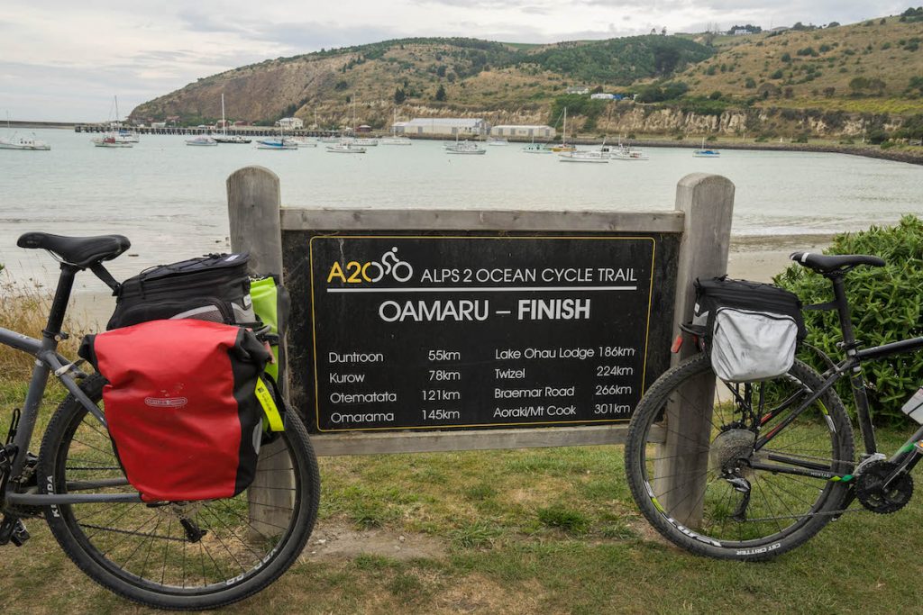
A nice flat ride along an old railway line and through the botanical gardens and there we were in Oamaru. The end of the line.
Funny though that literally in the last 200m we took a wrong turn. It was easy when there was just one trail heading through the wilderness, but these towns were tricky! We had managed 305.8km without mishap and now here we were. Ha ha! Luckily we could see the ocean from there.

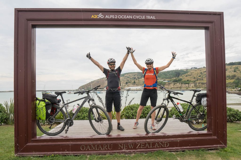
We were excited to reach the finish but were also a little sad. Both of us agreed we could happily just keep riding. And my butt was not even sore!
Gear & Logistics
Logistically, the A2O is really easy. You can sort everything out yourself or there are a number of companies that can help out.
Bikes
We hired hardtail mountain bikes from Cycle Journeys. We decided it would be easier than carting our own bikes over from Australia. Their depot is conveniently placed in Twizel which is on the trail. The bikes were kept in excellent condition and had puncture proof tyres. Indeed we had no trouble at all with them.
Luggage
The bikes came with one 8L pannier bag each, but we wanted to carry all our gear with us so we hired two 20L bags as well. These were tough and waterproof and fit a surprising amount inside.
The other option with luggage (and the most popular option by the looks of it) is to have Cycle Journeys (or another company) shuttle your bags between hotels and you just carry with you what you’ll need for the day.
Getting to and from the trail
This was the most confusing part of the planning for me, but it turned out to be quite easy. We gave up on the idea of hiring a car from Christchurch and took a bus to Twizel instead. Cycle Journeys picked us up from the bus stop and took us to their depot where we picked up our bikes and bags. They then shuttled us the 50 minutes up to Mt Cook Village and the start of the trail.
In Oamaru we left the bikes at a Cycle Journeys drop-off point and caught the bus back to Christchurch. Easy!
Accomodation
Cycle Journeys can book all your accomodation for you but I booked our own using Airbnb and Booking.com. Some of the towns are very small so have limited options, so best to get in as early as possible.
Help along the trail
Because Cycle Journeys has a van going along the route every day (to transfer luggage), if you decide you want to swap your bike for an e-bike just for a day (perhaps one of the hilly days) they can arrange that for you. And if you have any trouble along the way and need to be picked up, they can collect you and drive you to your next accomodation. It’s kinda nice to know they are there if you need them. In fact, one of our pannier bag straps broke and they were able to deliver a new one to us at the next town.
There is also phone reception most of the way along the trail.
Clothing
Since we were carrying all our gear on the bikes we had to pack light. Merino shirts and my new favourite deodorant No Pong (which is totally awesome and life-changing by the way) made it possible to wear the same shirts every day, without washing them and still NOT SMELL! Hooray! I took two pairs of cycling knicks but only wore one. I just washed it out by hand each evening and it was dry (mostly) by morning. We had a clean set of clothes that we would change into each evening after our showers (these were merino too!).
In case you’re wondering, my favourite merino clothing is ioMerino.
There are of course other companies that can do the same thing as Cycle Journeys, but I can’t vouch for them. I was very happy with Cycle Journeys and would use them again next time.
Yes, next time! It was too much fun not to do again.
I had two aims for this trip: travel 306km under my own steam; and take stacks of photos. Done and done! Hooray! Actually there was a third aim but I do not know if it was successful. It was to not annoy Mr Ironman too much by stopping every ten minutes to take photos 😀
Disclaimer: I do not get paid by any of the companies I have mentioned in this blog. I just really like them! Though ioMerino do give me a piece of clothing every once in a while 🙂